The Blue Nile
From Lake Tana to the lowland border — the river Ethiopia calls the Abay. Scroll — the map travels with you.
Lake Tana
Ethiopia's largest lake, high on the Amhara plateau. From its southern shore flows the river the country calls the Abay — known to the wider world as the Blue Nile.
Sources: Britannica — Lake Tana
Tis Abay — "the great smoke"
A short way downstream the young river drops over the Blue Nile Falls, called Tis Abay — the great smoke — for the spray that hangs over the gorge in the rainy season.
Sources: Britannica — Blue Nile River
The great bend
The Abay then carves one of Africa's deepest gorges, sweeping in a vast clockwise arc around the highlands of Gojjam — a canyon that for centuries made the river almost impossible to follow on foot.
Sources: Britannica — Blue Nile River
Into the lowlands
Leaving the mountains, the river descends toward the hot western lowlands of Benishangul-Gumuz, gathering the tributaries that make it the source of most of the Nile's floodwater.
Sources: Britannica — Blue Nile River
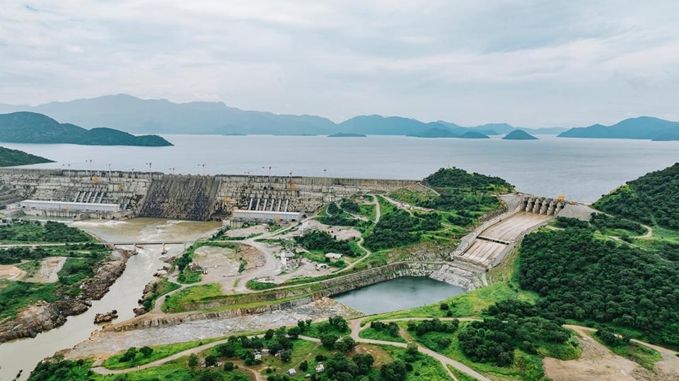
The Grand Renaissance Dam
Near the Sudanese border the Abay now meets the Grand Ethiopian Renaissance Dam, Africa's largest hydroelectric project and the subject of long-running negotiations among the Nile states — this Atlas records the landmark and takes no position.
Leaving Ethiopia
Beyond the dam the river crosses into Sudan on its way to Khartoum, where it joins the White Nile. Roughly two-thirds of the water that reaches Egypt begins as rain on the Ethiopian highlands you have just travelled.
Sources: Britannica — Blue Nile River